HIGH TECHNOLOGY
We have advanced exploration technology that allows us to locate important archaeological remains yet unknown, lost and buried in different areas of our planet. Their location and conservation are of incalculable historical value and contribute to the preservation of our world archaeological heritage.
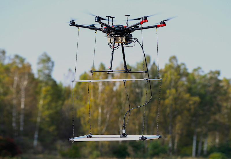
Remote Sensing + Drone
AIR AND GROUND PROSPECTION EQUIPMENT
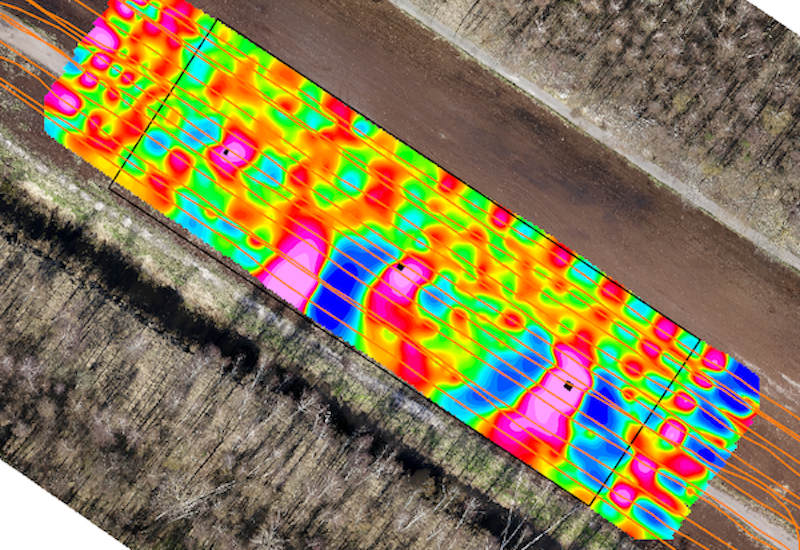
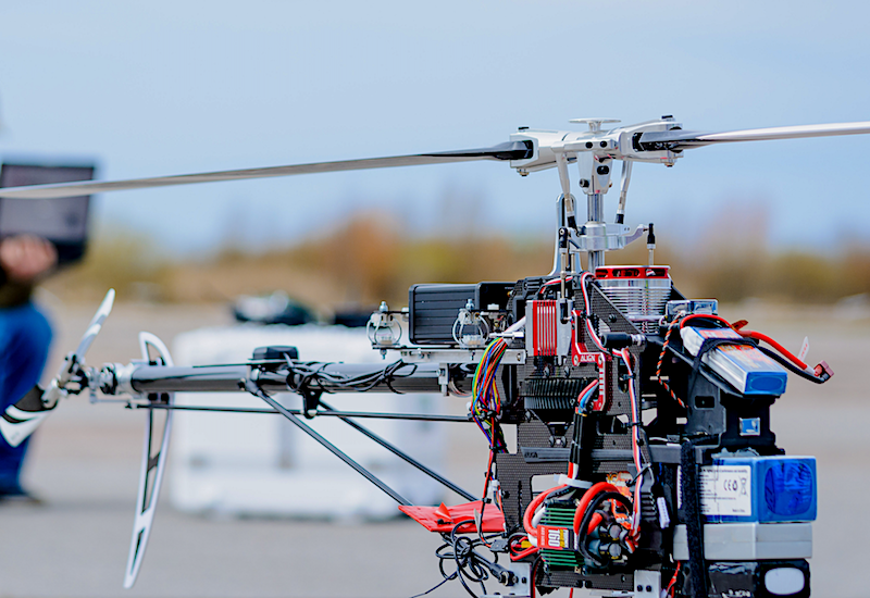
Currently for the area of archeology we use very advanced techniques in remote sensing using drones with GROUND PENETRATING RADAR (GPR) systems incorporated. With this technology we use antennas of different frequencies being able to reach depths of up to 25 meters. In turn, in special required jobs we use LIDAR and THERMOGRAPHY systems.

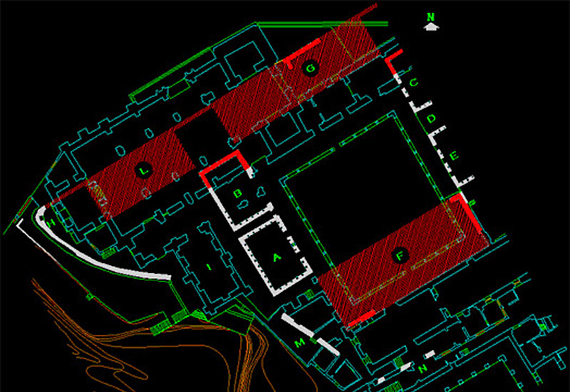
Archaeo-Geophysics
One of the most complex challenges of archaeology is the identification and protection of buried archaeological heritage and the need to manage, maintain and inspect underground services. Archaeology and Geophysics (Archaeo-Geophysics), used in an integrated way, provide an important contribution to open new perspectives in understanding both the history and in helping the decision makers in planning and governing the urban development and management. The problems of identification and interpretation of geophysical features in urban subsoil make it necessary to develop ad hoc procedures to be implemented and validated in significant case studies. We use our instruments such as Conductivity, Ground Penetrating Radar (GPR), Magnetometry-Fluxgate, Magnetometry-Optical, Magnetic Susceptibility and Resistivity - Twin Probe to measure differences in soils and objects buried in the soils.
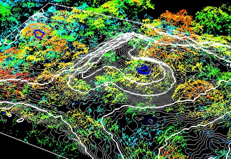
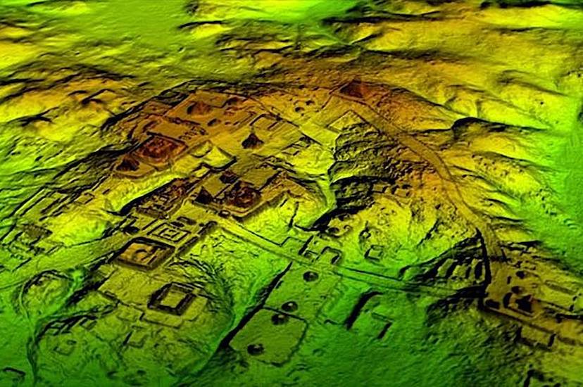
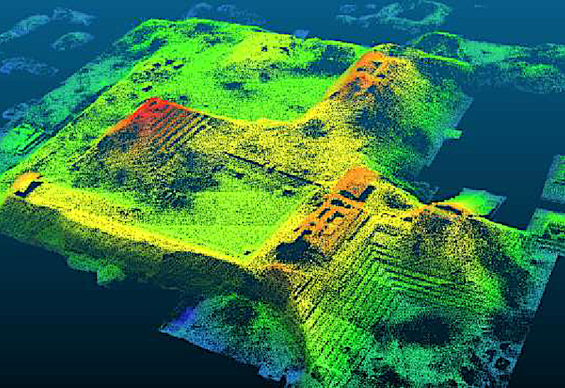
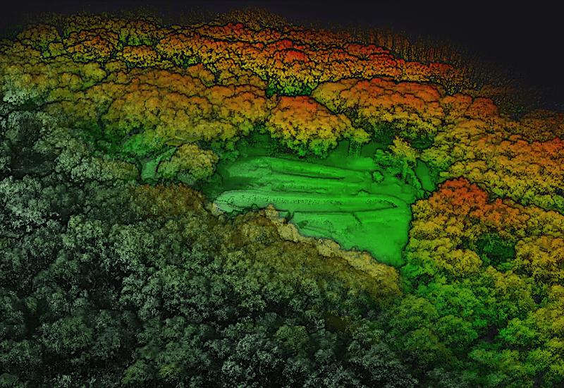
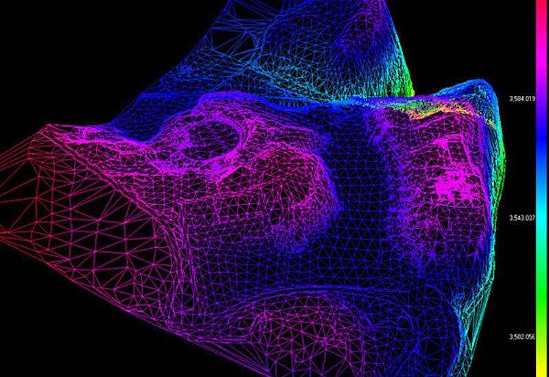
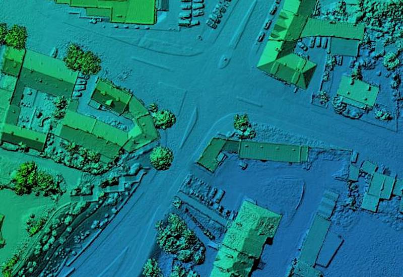
LIDAR + Thermography
LIGHT DETECTION AND RANGIN (LiDAR) and Thermography has changed the face of archaeology by making it possible to measure and map objects and structures that might otherwise remain hidden. Our technical department has this advanced technology at its disposal for cutting-edge archaeological research.
- Airborne LiDAR
- Terrestrial LiDAR
- Bathymetric LiDAR
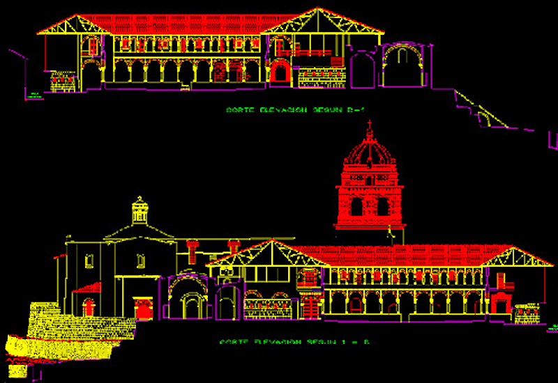
CAD / GIS
Using powerful computer-aided design (CAD), 3D and geographic information systems (GIS) software, we produce the digital cartography necessary to study, evaluate and manage the environmental aspects of all our projects.
- Design and creation of GIS, CAD and spatial data base files
- Creation of thematic environmental, analytical and synthetic cartography
- Digital terrain elevation models
- Computer graphics, 3D simulation and virtual flight
- Detailed reports, statistics and analysis of cartographic data
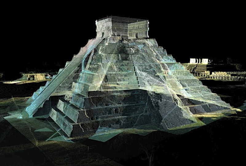
3D scanning with photogrammetry and laser scanning for heritage
RealityCapture tutorial: Merging exteriors and interiors of buildings Learn how to merge the interior and exterior of a 3D scanned building.

Julio Durand
Head of Technology Systems & Teledetection
- Lima (Peru)
- Systems Engineer - University of Lima
- Remote Sensing and Unmanned Vehicles Specialist Technician
- Chief Drone Operator
- ITC Certified Level - Thermographer
- Specialist in remote sensing systems with drones in archaeology
- Geospacial & thermal infrared imaging and multispectral sensors